
Achi news desk-
The combination of warm, moist air that has accumulated this week together with a cold front arriving from the west has triggered thunderstorms in the Maritimes.
Thunderstorms swept across northern New Brunswick Thursday morning until early afternoon. Along with lightning, the thunderstorms produce some rainfall rates as high as 20 to 40 mm per hour. That heavy rain can reduce visibility and lead to water logging on roads. The storms are moving quickly to the east at 50 to 60 km/h. The rapid speed of the storms reduces the risk of flooding.
Thursday afternoon risk
A second round of showers and scattered thunderstorms is expected to develop and move across New Brunswick Thursday afternoon into the night. The risk first starts in the north-west region of the state in the early afternoon. Then the risk of thunderstorms becomes more common in the late afternoon and through the first part of the night for the province. During that period, there is also a risk to the west of Prince Edward Island. The risk of thunderstorms should be reduced for New Brunswick and Western PEI by 8 to 10 pm
A second round of scattered thunderstorms is expected to develop and move west to east across New Brunswick Thursday afternoon into the evening.
As of midday Thursday, Environment Canada has issued a severe thunderstorm watch for most of western New Brunswick. A severe thunderstorm watch means conditions are favorable for thunderstorms that could produce showers, strong wind gusts and significant hail. A severe thunderstorm warning is issued when a dangerous storm is imminent or occurring. For safety, it is best to shelter indoors when there is a thunderstorm in the vicinity. Wait 30 minutes after the last rumble of thunder before heading back out.
Thursday night risk
As the front that triggers the thunderstorms moves towards PEI and Nova Scotia on Thursday night, the risk of thunderstorms for those two provinces will increase. The risk of thunderstorms for PEI will be highest between 6pm and midnight. The risk of thunderstorms for Nova Scotia is highest between 8 pm and 2 am Guysborough, Richmond, and Cape Breton counties in eastern Nova Scotia remain at a lower risk until near 6 am Friday.
The thunderstorms will be scattered in coverage, so not every community will have a single pass over. Lightning will be the most common hazard with the thunderstorms. Some may be able to produce heavy rain.
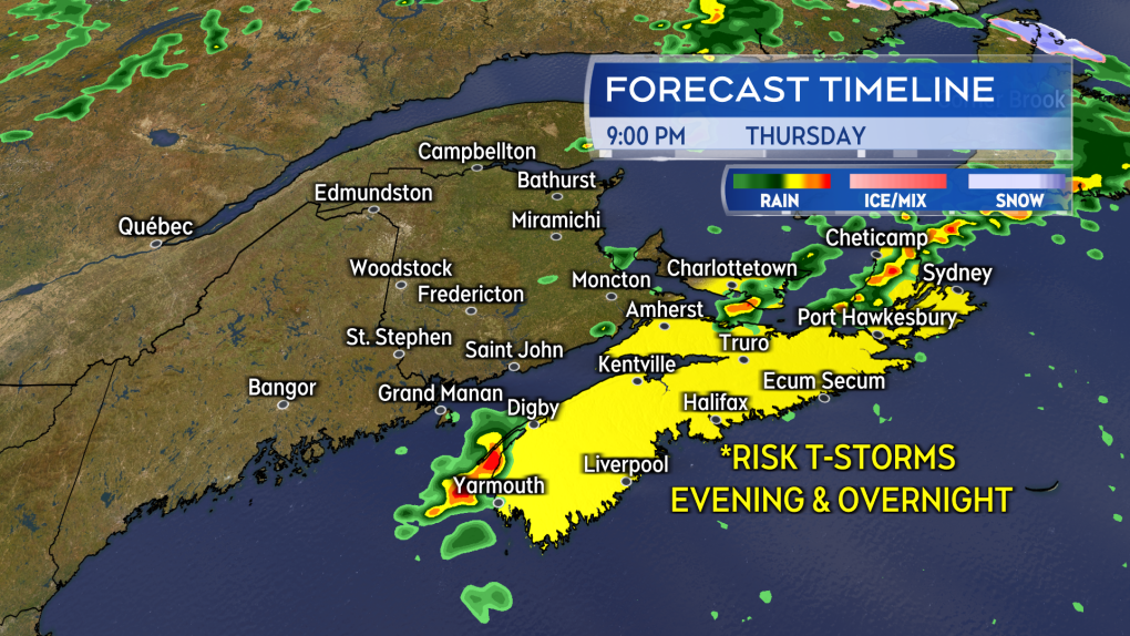 Increased risk of thunderstorms Thursday evening and overnight for Nova Scotia and Prince Edward Island.
Temperature and humidity forecasts
Less moist air is located behind the front. Much of the week’s smog will be out of the sky for New Brunswick on Friday and will descend on Nova Scotia and PEI.
High temperatures are still expected to be well above average for late May on Friday. Areas off the coast are again likely to reach the mid-to-high 20s. High temperatures will cool for Saturday with high twenties and low twenties for New Brunswick and mainland Nova Scotia. Closer to the mid-teens is expected for PEI and Cape Breton.
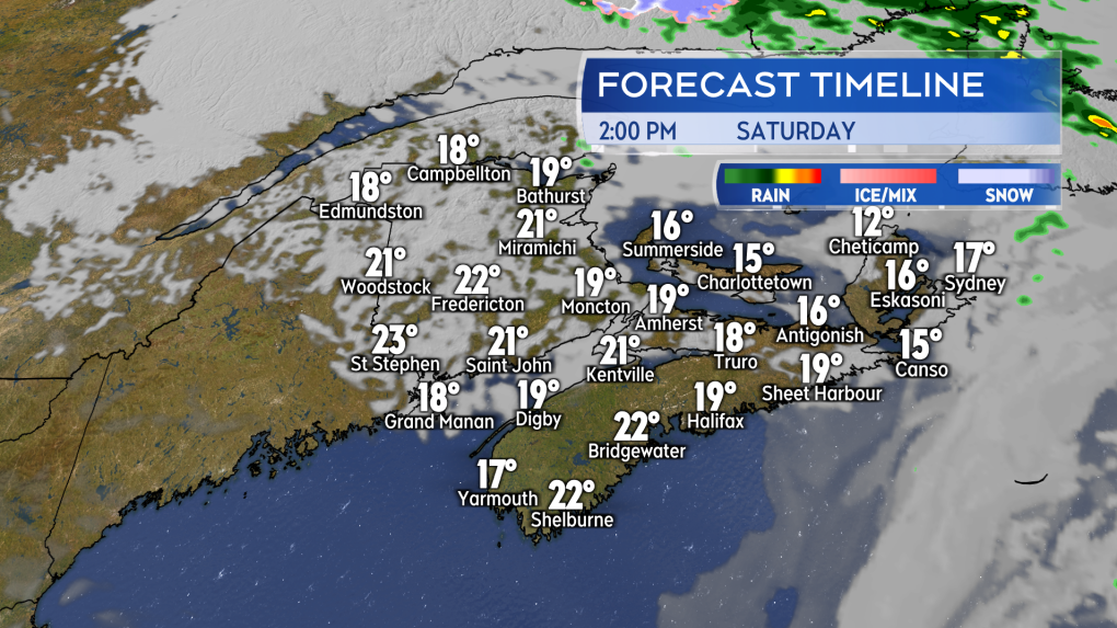 Quite a nice start to the weekend. Sun and mixed clouds, slightly cooler and drier air compared to much of this week.
