
Except translation, this story has not been edited by achinews staff and is published from a syndicated feed.
Records are falling
As we moved into the late afternoon, high temperature records for June 19 fell across the three Maritime states.
Many other weather observation sites in the region came within a degree or less of their standing highs.
At 5 pm ADT Bathurst, NB, had the hottest temperature in the country as recorded at weather stations monitored by Environment Canada. He recorded that high temperature as 37.6 degrees Celsius.
New daily high temperature records set in the Maritimes. Unofficial at the moment but some of the sites setting new records are shown here highlighted in yellow. (Source: CTV Atlantic)
Peak heat and humidity
The Maritimes are now at the height of the hot and humid weather. Similar conditions are expected on Thursday. Heat warnings remain in effect for the three Maritime states as not only will the days be very hot, but the nights will be very warm, offering some relief.
A cold front is moving across the Maritimes late Thursday into early Friday. Less moist air will seep into the Maritimes on Friday. Temperatures and humidity are forecast to drop from Wednesday and Thursday levels. Temperatures and humidity will drop a bit more at the start of the weekend.
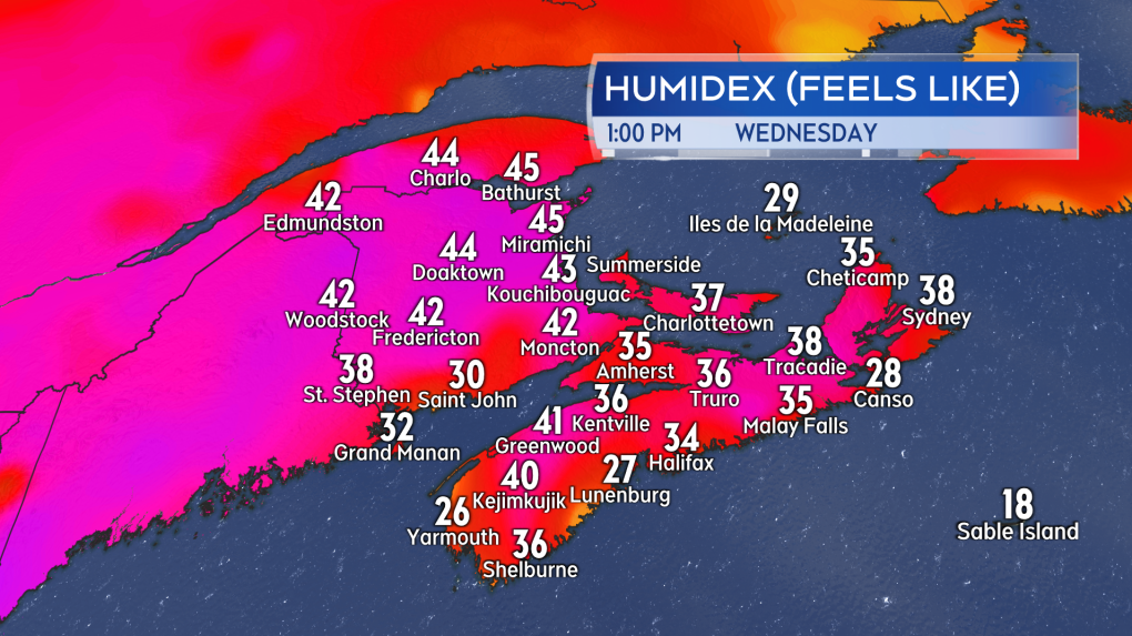 Afternoon humidex values in the Maritimes, or what it feels like, taking temperature and humidity into account, well into the 30s and in cases the 40s.
Danger of thunderstorms
Heat and humidity can fuel thunderstorms. There is a low chance of afternoon and evening thunderstorms in New Brunswick for Wednesday afternoon and evening. Any thunderstorms that develop will be isolated and so for any given community there is about a 20-30 percent chance.
There is an increased risk of scattered thunderstorms in the Maritimes Thursday.
Thursday’s thunderstorm development would be triggered by the cold front moving from north to south across the Maritimes. The highest risk will be for Thursday afternoon and early evening in southern New Brunswick, Prince Edward Island, and eastern Nova Scotia. There will also be a risk of thunderstorms in western Nova Scotia on Thursday and Thursday night.
Due to the heat and humidity that will have accumulated, it is possible that some of the thunderstorms could be strong or severe. Hazards would include lightning, strong local wind gusts, and rain.
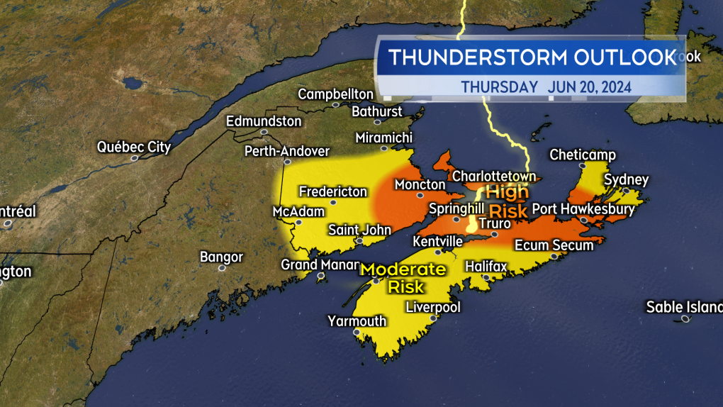 There will be an increased chance of thunderstorms in the Maritimes Thursday along with an increased risk that some of them could become severe.
Tropical Storm Alberto
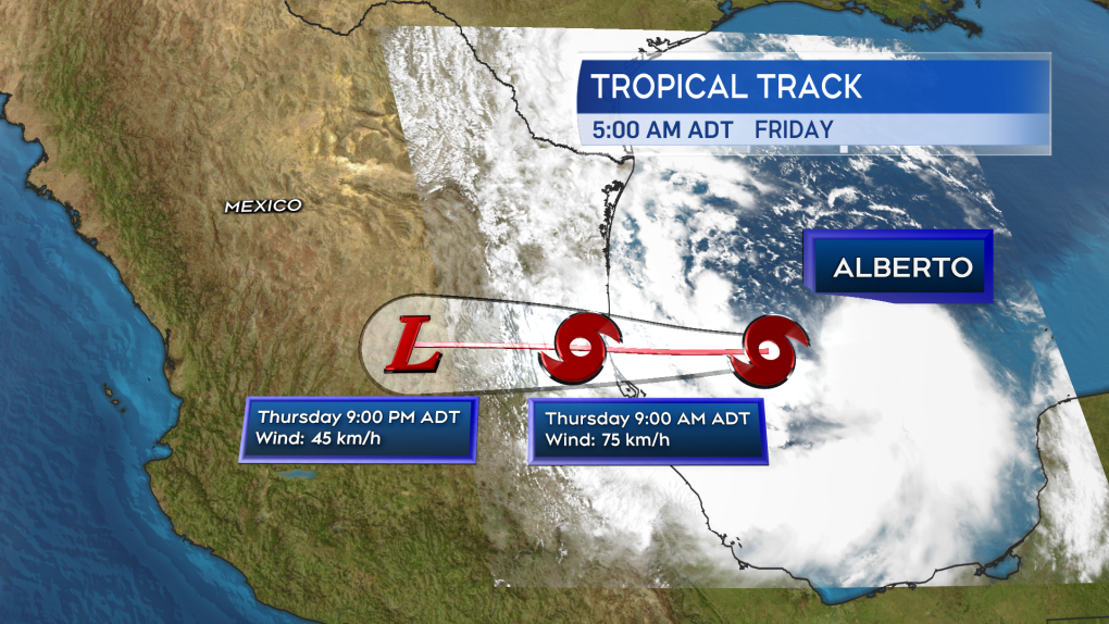
Tropical Storm Alberto developed Wednesday morning in the Gulf of Mexico – the first named storm of the 2024 Atlantic hurricane season. The National Hurricane Center is issuing advisories and forecasts for the storm. The storm is expected to move ashore near the border of the states of Tamaulipas and Veracruz, Mexico, early Thursday morning.
The storm could bring areas of rain, as much as 120 to 250 mm, to parts of northeastern Mexico and southern Texas. The rain will bring a risk of flash floods and a risk of mudslides where it comes down on more mountainous terrain.
 The forecast cone for Tropical Storm Alberto in the Gulf of Mexico per the National Hurricane Center.
(Except translation, this story has not been edited by achinews staff and is published from a syndicated feed.)
source link https://atlantic.ctvnews.ca/records-to-watch-as-temperatures-soar-in-the-maritimes-wednesday-1.6932924
